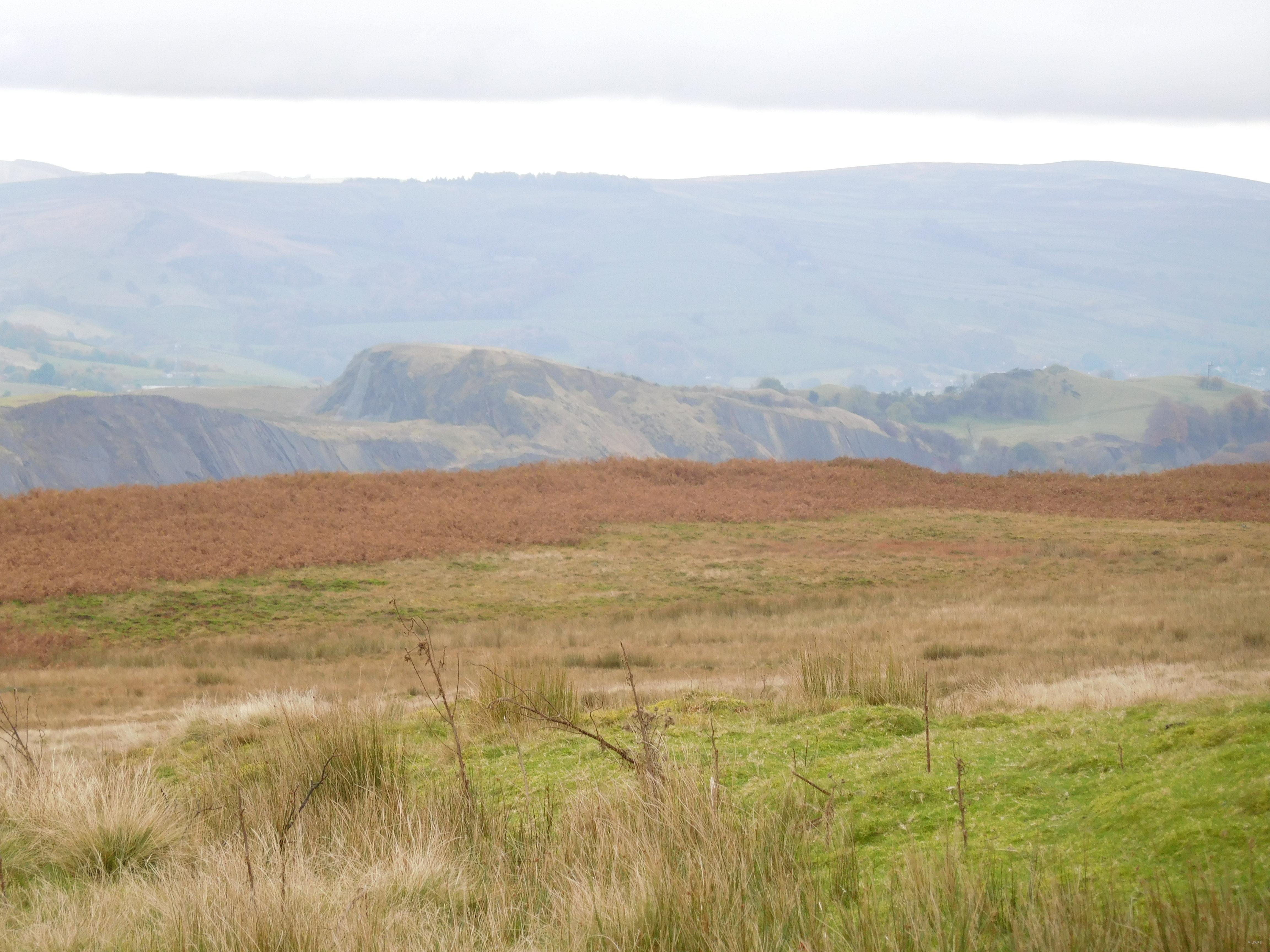
From the top of Black Hill, between Eastby and Barden, we had an excellent view of the Skipton Anticline with Haw Park Quarry in the centre, Embsay Crag to the right and Draughton Moor to the left. Further to the west we could see Pendle Hill and the smoke rising from the cement works in Clitheroe.

Limestone Quarry in the Skipton Anticline. Photo Ann Shaw
We are now in the Craven Basin, no longer on the Askrigg Block, and looking at Early Carboniferous sedimentary rocks formed in deeper sea and affected by earth movements causing minor and larger folds.

Skipton Anticline from Raistrick
The Skipton Anticline and its neighbouring Barden Syncline are what we have come to look at. When the rocks were folded and later eroded the underneath older layers become exposed in the centre of the fold, thus the Limestone became accessible to the quarry men.
Starting at the hole-in-the-wall in Bolton Abbey, on the southern flank of the Skipton Anticline, we walked down towards the bridge and stepping stones crossing the Wharfe.

Vertical bed of Bowland Shale. Photo Jim Hutchinson
Here there is a steep cliff of fine dark material with one or two lighter ribs, this is Upper Bowland Shale and ribs of muddy Limestone.

Skipton Moor Gritstone. Photo Jim Hutchinson
To the right, and separated by a small fault, are blocks of younger bedded and jointed gritstone, Skipton Moor Grit. Across the bridge we could find the friable Middle Bowland Shale.

Folding at Bolton Abbey. Photo Ann Shaw
Travelling upstream but looking across the river in the bank beneath the Priory was a wonderful fold, missed by many of the other visitors. Here are layers of easily squashed shale between stronger more definite layers of muddy limestone. Walking along the riverside path we saw layers of almost vertical rocks in the water’s edge, along with Dipper and Goosander.

Old river levels .
Photo Ann Shaw
The fields on the other side of the river reveal several old river terraces showing how the flow of the river has changed over the years. Walking through the woods and just past the Pavillion bridge we found an old quarry revealing a bank of unsorted local rocks, a lateral moraine left by a glacier.
Passing through crowds of families doing the Spooky Trail, and secretly enjoying the squeals of fright and delight, we made our way up to The Strid. Now we have passed into the Barden Syncline filled with younger course Gritstone, and the river flows smoothly and quietly. Where the Wharfe has exploited a joint in the rocks, formed large pot-holes which have joined up to form a deep, about 10 metres, narrow channel we have come to the well known Strid.
During the walk back two of us were lucky enough to see a Kingfisher flying up river, the others had to settle for the colourful Mandarin Ducks.
For the walk we used John Varker’s chapter in Yorkshire Rocks and Landscape, A Field Guide published by the Yorkshire Geological Society.
Leader Josephine Drake


