A Visit by Four Members of the Local History and Vernacular Buildings Group
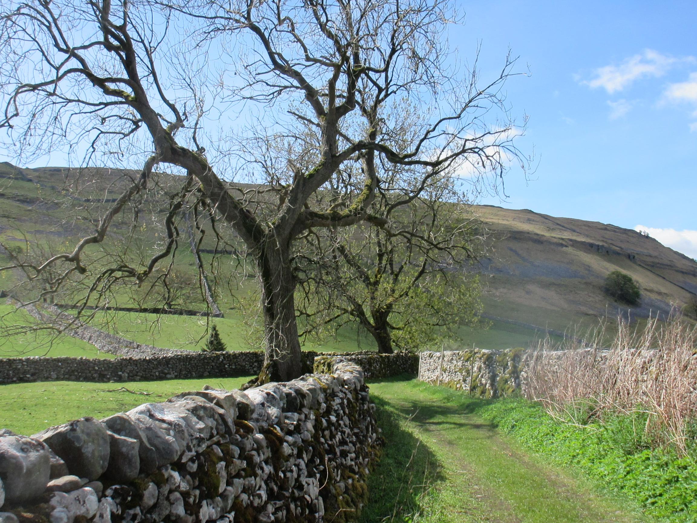
Bracewell lies on the B 6251 between the A 59 and Barnoldswick, now in Lancashire, but formerly in Yorkshire. It forms part of the civil parish of Bracewell and Brogden. The main purpose of our visit was to look at the church, as there is very little else left of the village, but it has an interesting history, and we enjoyed its tranquility and quietness.
Domesday
In 1086 the Tenant-in-chief was King William, having taken it from Earl Tosti in 1066. It was then given to Roger of Poitou. The local Lords in 1066 were Arneketil and Ulfkill, and most of the land was described as waste.
The name ‘Bracewell’ is thought by Margaret Gelling to have derived from Old Norse or Old English as meaning ‘Breith’s spring’, ‘well’ meaning spring or stream, with ‘well’ being most common in settlement areas. The second largest category of names which include ‘well’ is where the first element consists of a personal name.
As with other early churches, St Michael’s at Bracewell began as a private chapel, this one for the Tempest family, a branch of which lived in Bracewell, and dates from the 1100s.

St Michael’s church, Bracewell
The church appears to have served Bracewell, Brogden and the deserted medieval village of Stock, and maybe East and West Marton. Brogden is the area to the west of Bracewell, and does not appear to have a village centre, although there is a farm manor house still lived in, within the boundary.
The Deserted Medieval Village of Stock
The vill of Stock lay to the north of Bracewell, between the church and the A59, and in Edward I’s reign, between 1272 and 1307 the Chartulary of Sawley recorded that Alan, the son of William of Stock granted to the Abbey a right of way across his land, between the king’s highway, and Stock Bridge. This allowed animals to be driven to land in Marton which had been granted to the monks. Richard Tempest was one of the witnesses to this agreement. Although today there is little to see, the villagers possibly moved out when the land was given to the abbey which was being established at Barnoldswick. This failed to flourish, and moved to Leeds to become Kirksall Abbey. The site is important as a good example of a medieval settlement in an area of isolated halls, single farmsteads, hamlets and villages. House platforms, wells and hollow ways have been identified, and possible an area of lime burning. Ridge and furrow markings suggest an open field system of farming. More detailed information can be read on the Historic England website.
Roman Road and Two Ancient Settlements
The line of the roman road from Ribchester to Ilkley runs through Brogden, and just south of Bracewell. Earthworks marked on OS sheet 103 to the south east of Gisburn just off Coal Pit Lane, are known as Bomber Camp. Dated from the mid to late 4th century AD, they are thought to be remains of a Romano-British camp, villa or settlement. (For more information see sources). Another earthwork shown on the OS sheet, is a camp on Hawber Hill, “the origin and purpose of this earthwork is unknown, though Dr A. Raistrick was of the opinion that it could not be pre-Roman. His assessment of a possible dating is confined to the discovery of Md. pottery in a similar, though unspecified earthwork near Skipton.”
The name lives on and now applies to an area of scattered farms.
St Michael’s Church
The church was built as a private chapel by the Tempests for the family and household, probably very early in the 12th century, as Bracewell was the original home of the family. Some of this remains, but most of what we can see in from later centuries.

15th century tower showing clear evidence of earlier roof on eastern side.
The tower is 15th century with unbuttressed walls five feet (1.5 m) thick, and from the outside show the outline of a previous roof. The south door from the porch to the nave is 12th century, and the pointed arch which links the nave to the tower is 14th century. The round chancel arch is Norman, its supporting capitals bearing typical scalloped decoration. The north aisle was added in the 14th – 15th century, by Sir Richard Tempest, according to Whitaker, who also enlarged the Tempest chapel.

Scalloped capital inside the church
The arcade is of two bays with octagonal columns two of which have a now empty niche.

Tempest niche in pier in the North Arcade, which only appear in Tempest churches in Craven
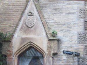
The windows are of various dates and styles, with stained-glass depicting the coat of arms of families connected with Bracewell.

The Tempest coat of arms is on the right
A vicarage was ordained in 1374, but by the 19th century Whitaker described the house provided for the incumbent as having two rooms, an earth floor and open to the thatched roof “much better adapted to the accommodation of hogs than men,” and a disgrace to the parish and the Church of England.

King Henry’s Barn (possibly)
It is part of the popular local history lore that Henry VI spent time in the Ribble Valley after his defeat at Hexham. He was in fact captured trying to leave Waddington Hall, where he been the guest of Sir John Tempest and his wife Alice, who used the halls at both Waddington and Bracewell. A newer hall at Bracewell was built by Sir Richard Tempest, perhaps when he was Sheriff of Yorkshire in the reign of Henry VIII, to replace an existing stone building. The new one was unusual in that it was constructed of brick, one of only a few in Yorkshire at the time. But the family fortunes waxed and waned, and by the 17th century, Richard Tempest, a colonel in the army of Charles I, squandered what was left of his inheritance, had the house pulled down, and passed the estate to a distant cousin, which caused problems within the family for generations. A new hall was built in 1869 by James Turner Hopwood, which then belonged to Mr Riley of Richmond, before being used as a private school for boys.
Village People
The Subsidy rolls of 1379 show Richard Tempest paying the most tax (20d), followed by Perot Tempest (11d), for themselves and their wives. Everyone else paid the minimum 4d – one groat, except for Willibus Smyth, who paid 6d for himself and his wife. He was described as a ‘fabar’ and was probably a smith.
The Lady Day Hearth tax of 1672 records twenty-eight dwellings, with 2 of those with 6 hearths, 1 with 5, 2 with 3, 12 with 2, and the rest with a single hearth, which suggests an area of some prosperity.
By the nineteenth century Baines Directory of Trades and Professions recorded two gentlemen in Bracewell, Ayrton William and John Cockshott, and there were two shopkeepers, John Carr and Christopher Hornby, and later different trades and professions, including a Post Mistress – Mrs. Fenning.
Vernacular Buildings
Near to the gateway to the church is a Bracewell Hall barn, which was probably adapted from a house, and incorporates King Henry’s Parlour, and dates from the 15th century. There are some modern houses to the immediate south of the church, but most if the other farms in Brogden and Bracewell are from the 16th, 17th, and 18th centuries. Many have been altered, but most of them are listed buildings, and display sufficient evidence of their origins to be dated.
Lower Calf Farm house, which I cannot find on a map, dates from the 17th century, as does Turpit Gate House farmhouse, Wedacre farmhouse. The 18th century saw the building of Hopwood farmhouse (on the lane just along from the church), Jack House, off Brodgen Lane, Manor House, Brodgen, and Yarlside farmhouse, not far from the turning from the A59. In the next century Hopwood House was built looking across the graveyard to the church, and Newhouse Farm.
On the opposite side of the road through the village is the former post office, and which is now someone’s home.

The Old Post Office
Today, one can drive through Bracewell in a matter of seconds, unaware of its long history, and the lives of so many people who have lived and worked there.
Marion Hutchinson
Photographs: Phyllida Oates
Sources
Place-names in the Landscape: Margaret Gelling
The Chartulary of the Cistercian Abbey of St Mary of Salley in Craven Vol 1
Bomber Camp: Historic England
Hawber Hill: Historic England Research Records
Stock medieval settlement and part of its associated medieval …
https://ancientmonuments.uk › 118564
Gilbeber Hill Earthwork, Near Greenberfield, Lancashire | The …
https://thejournalofantiquities.com ›
Outstanding churches in Craven: Val Leigh & Brian Podmore
The Buildings of England Yorkshire West Riding Nikolaus Pevsner: Second edition id Radcliffe revised by Enid
The History and Antiquities of the Deanery of Craven on the county of York Thomas Dunham Whitaker
A History of Yorkshire David HeyPlace- Names in the landscape Margaret Gelling
Bracewell Directory of Trades and Professions for 1911
https://britishlistedbuildings.co.uk/england/bracewell-and-brogden-pendle-lancashire#.YJVa1bVKjIU
https://oneguyfrombarlick.co.uk/viewtopic.php?t=6703 Bracewell School