By Kay Greenhalgh
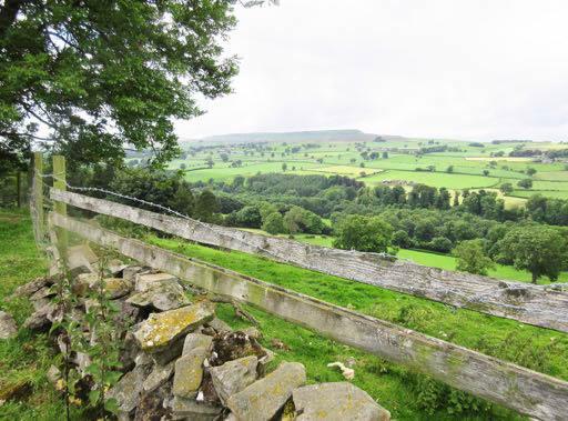
In a stiff breeze but good sunshine our group set off from the busily equestrian town of Middleham, along the full length of the Gallops and into Common Lane. The long gentle climb allowed us expansive views all around, and we maintained the height as we turned south on Middleham High Moor where we had lunch. The route continued through heather and bilberries, and approached the ancient farmland of Melmerby. This landscape was
certainly farmed by norsemen, then the Lords of Middleham, yeomen, and eventually handed down to present farmers, although farms today are apparently much smaller.
Our downhill progress brought us to the verdant River Cover where we lingered briefly to absorb this special place, including the riverside ruin of the 1328 St. Simon’s Chapel. The wooded climb up from the river on the southside opened into the welltended pastures of East Scrafton where we turned east. Two steep and lush gills were ahead before we entered the hamlet of Caldberg, with its 17th century Hall and barns. This path followed a long, high edge which gave a vast and unbroken aspect across the Cover valley, behind us the Caldbergh Moor, and eventually we entered Coverham below. The single-span pointed arched bridge here is considered to have been built by the monks of Coverham Abbey in the 15th century, (often repaired), and was part of an important packhorse route from Bolton Priory and Kettlewell, over Park Rash. Having passed the church and the Abbey, the wooded path took us alongside the river again briefly before the final climb up onto the open pastures which led us back, past the imposing mass of the Nevilles’ medieval castle, into Middleham. This ten
mile walk presented great diversity of interests and terrain, appreciated by a happy group.


