CB Octagon Smelt Mill and CB New Smelt Mill, Langthwaite, Arkengarthdale
These were both situated within a rich lead mining landscape in an area, now scheduled, that includes many mining features.

First of all a word about the smelting process with some information and a diagram taken from
https://www.mylearning.org/stories/lead-mining-in-the-yorkshire-dales/69
The smelting process is essentially very simple. The Galena was heated until it reached melting point. Because lead has a low melting point any impurities are not melted and are left as waste. The molten lead can be allowed to drain from the ore hearth into a collecting pot and then poured into moulds to form blocks of pure lead metal.
- To achieve the temperatures necessary to smelt the lead from the Galena requires a source of fuel. This was originally found by coppicing local woodland but by the time this mill was built fuel was supplied by cutting and drying moorland peat which was in plentiful supply.
- A constant stream of air, to aid combustion, was also needed and was provided by the use of a water wheel to drive huge bellows that kept the furnaces supplied with air to aid the smelting process.
- The heated Galena gives off poisonous fumes (particularly Sulphur Dioxide and also Vaporised Lead). In early small scale smelting these escaped into the atmosphere but in large scale mills the fumes needed to be removed efficiently. Large flues (horizontal chimneys) were built up hillsides and were topped with a vertical chimney.
- Because of their small size children (boys) were sent into the flues to scrape condensed lead from the walls to return it for processing. What a hazardous job that must have been.

The diagram above shows a key to the lead mining progress
CB – Charles Bathurst
The lead-mining in Arkengarthdale was dominated by the CB (Charles Bathhurst) Company which was founded in 1654 when a Dr Bathurst purchased from the Crown the whole of Arkengarthdale and the right to mine in the area. The estate remained in the Bathurst family for four generations, until in 1740 it was inherited by Charles’s three great-granddaughters. In this day and age it seems incredible that at that time married women were not allowed to own property, so the estate became officially owned by their husbands.
In 1800 the mines of Arkengarthdale were let for 21 years to a Newcastle company for a fixed rent rather than a percentage of the lead mined. This company, under its manager Frederick Hall, invested heavily in new technology and spent a large amount of money in 1803 when they built the Octagon Smelt Mill.
CB Octagon Smelt Mill 1803 – 1822
Built in 1803, the magnificent Octagon mill (so named because of its unique shape in plan) measured 32.61m by 21.34m internally and was built on a terrace cut into the hillslope. At the time it was one of the largest buildings in the Dales. It employed six ore hearths with a 10.97m diameter overshot waterwheel providing power for the blowing apparatus.
Sadly however it had a very short working life. When new lessors took over in 1821, building began on a new mill on the other side of the main road only 160 metres away.
Tyson states that “there could be several explanations for a new mill being built. One was that the owner of the actual site did not wish smelting to carry on. Another might have been that the Octagon Mill, like its builders Easterby Hall, was more of a dream than a reality as it was no longer functioning properly. Most probably, the lessors simply wished to build a mill on land they owned rather than rent the Octagon Mill.”
Once the New Mill began smelting and was linked to the flue, the Octagon was no longer able to function. Historic England ascertained that it was short lived and stated the following “Built in 1803 and worked until 1822, Octagon mill will retain buried archaeological deposits providing a `unique opportunity to study the development of ore hearth technology at the beginning of the 19th century”.
 Photograph of the Octagon Smelt Mill shown here after closure (with the kind permission of The Swaledale Museum)
In the early 1900s it was thought that it functioned as a store and possibly a saw mill, as maps from that time show that there was a tramway linked to the area close by known as CB Yard. By the 1920s masonry had been removed from the hearths to build cottages in the area. However the real decay of the Octagon lead smelt mill began in the 1930s.
Ella Pontefract, in her book about Swaledale published in 1934, states that it was looking lost, was being used for storing carts, and that the wind moaned and whistled through the empty windows.
Parts collapsed in 1941 and the roof had completely gone by the 1950’s. Once unroofed, the building deteriorated and was steadily quarried for stone during the 1950’s and 1960s.
In an adjacent field there is a hexagonal Powder House, mercifully still intact.
 CB Powder House, shown here with the kind permission of The Swaledale Museum
For further old photographs and to see the mill in various phases of decline please see:
https://www.swaag.org/MUSEUM_ARCHIVES/DigitalArchiveQuickKeywordSearch_3.php and enter Octagonal in the search box. Please note that the first two photos which appear are of the CB New Mill.
Despite demolition of the main structure of the mill, stratigraphy containing important process residues will survive.

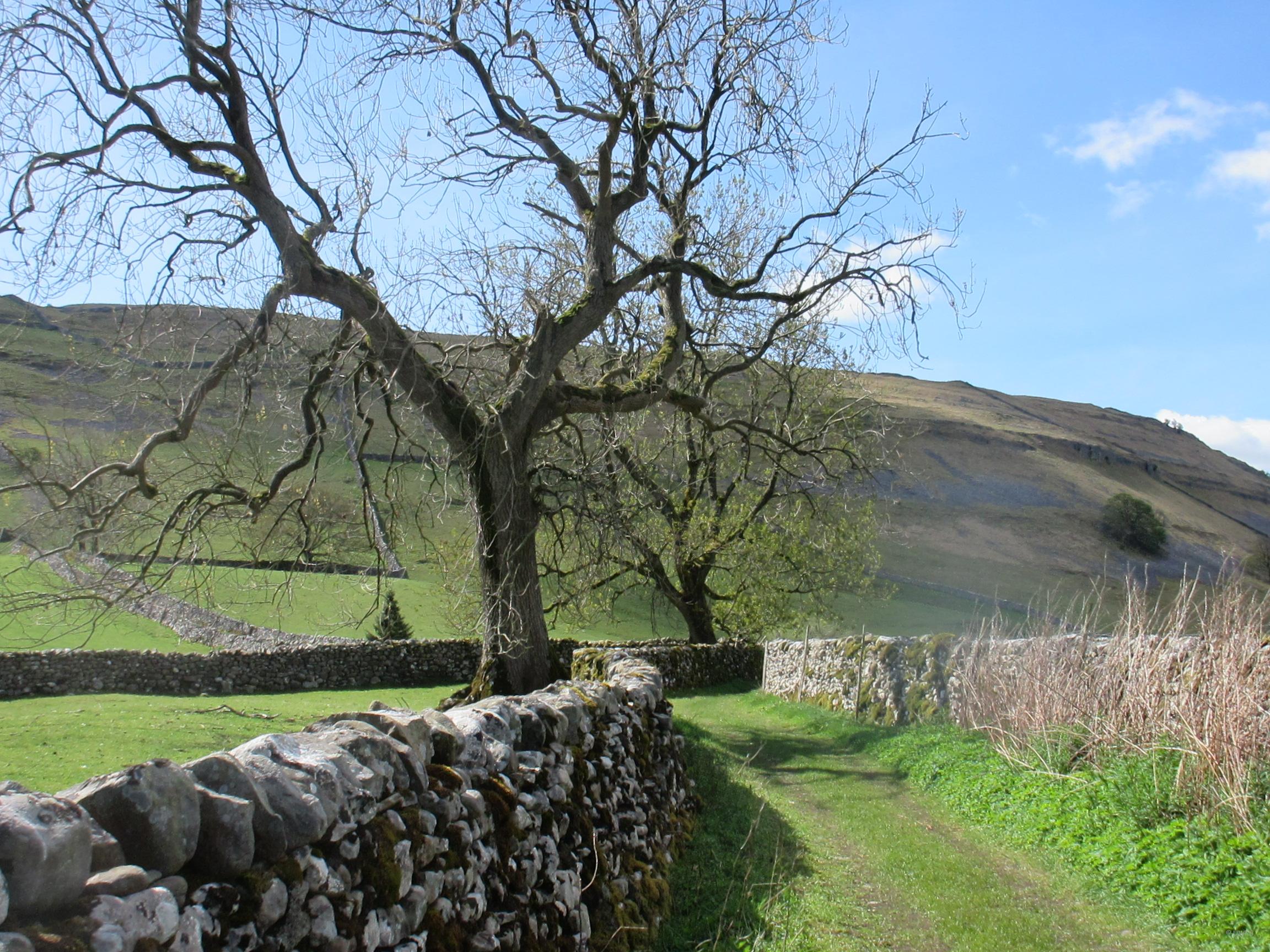
The site, on private land, as it is today looking South East showing the public right of way alongside.
 The site as it is today looking North West

The site as it is today, looking South West
The Peat Store
Although still standing today, albeit having been converted to a Cart Shed, it is very odd that this building has not been included in the scheduling.

The site photographed from the public right of way, showing the former peat store uphill on the left.

A close up of the peat store as it is today shows where the archways (built to let air into the store) have been blocked and a window and doors inserted when converting it to a cart shed.
The Flue
Fumes from the smelt mill were carried 810m along a 10m wide double arched flue which went underneath the Reeth to Tan Hill Turnpike Road and up to a chimney on Moulds Side. (See line in red on map). At the time this was the longest smelt mill flue in Yorkshire. It was extended at a later date (shown in blue).

This map is an adapted tracing by Marion Hutchinson from Raistrick’s The Lead industry of Wensleydale and Swaledale – Vol. 1. The original flue is shown in red.
The flue has mainly collapsed but the short section running up behind the Octagon Mill site and then under the main road is intact in places, as the next four photos show.


 Above is the point where the flue begins to go under the main road which is just behind the wall
 The flue, where it emerges from under the road and goes up the hillside.
 Up onto the moor.
 The end of the original flue with the collapsed chimney.
CB New Smelt Mill 1822 – 1901
In 1822 a new mill was built near the Octagon, by the side of the Reeth to Tan Hill turnpike road. The New or CB (Charles Bathurst) Smelt Mill employed six ore hearths and used a 160m double arched flue to connect with the Octagon flue and chimney on Moulds Side.

The building on the right is the Peat Store. Note the launder (large open wooden waterway) set on stilts on the left of the above picture. It is bringing water from a leat to drive the waterwheel.
(Photograph by kind permission of Mike Gill)
Clearly it was a very successful enterprise as it functioned for nearly 80 years.
The mill buildings were surviving largely intact until the late 1940s, though today only the north wall, standing approximately 4m high, survives to any great height. The presence of extensive wall tumble, however, suggests that internal features and archaeological deposits will remain.
 The site as it is today. Some of the cottages across the road were built with stone from the Octagon and this area is known as CB Yard.
Note the leat, bringing water from Black Mires Dam, running under the flue and then across at the foot of the heather clad hillside. A launder would have been linked to this, carrying water into the mill to drive the machinery.

Two photographs showing both sides of the north wall.

Two photos of the Wheel Pit

 The metal rods still survive that were used for bracing the walls to stop them pushing apart.

The fallen stone in the foreground is all that is left of the Peat Store, which was visible in the 1903 photograph.
The flue
From the map below you can see that the flue from the New CB Mill (shown in yellow) joined into the original flue coming from the Octagon Smelt Mill.
Sometime after 1854 it was extended (shown in blue) to higher up on Moulds Top, with a new Chimney giving a total flue length of 1.47km. The flue also connected with the old chimney via a 136m detour.

The red lines show the original Octagon flue, the yellow the link to it from the New CB and the blue one its later additions.
The map is an adapted tracing by Marion Hutchinson from Raistrick’s The Lead industry of Wensleydale and Swaledale – Vol. 1.
 The collapsed double arched flue which joined the main flue from the Octagon. Here, I am walking towards that point which is just above me on the horizon.

At the point where the flue was extended showing it leading straight up the hill
(Photograph by the kind permission of Janis Heward)

 Continuing up towards an area of chert mining.
There is a region where the all traces of the flue have disappeared because of the operation of Chert mines from1922 to the 1950s. Chert is a stone which was used to make grindstones for grinding a paste used to make fine porcelain. The Chert workings themselves have had a part in creating the present character of the area. It has a discernible tramline and is an area of great interest.

 This is where the flue becomes visible again just above the chert mining area.
 Out onto the open moor and nearing the end with mining spoil nearby.

You can see where the chimney fell to the right at the end of the flue.
 The site of the fallen chimney at the very end of the 1.46km long flue.
Moulds Top, where the flue terminates is a very large area full of mining interest and feels to be miles away from anywhere. I have spent days trying to trace levels, exploring workings and the huge Stodart and Hungry hushes – but that, of course, is another story.
Frances Bland
Local History and Vernacular Buildings Group
Acknowledgements:
My thanks go to the following people, for their help and advice
Mike Gill who gave me extensive advice and helped me sort out some of the misinformation that has been written about these mills.
Swaledale Museum for photographs.
Janis Heward for her advice and photographs, and Marion Hutchinson for map tracing.
British Mining No 33 – The Arkengarthdale Mines by Les Tyson and for the smelting information on the Maplearning.org website.